
Welcome to the San Dieguito River Park Trails!
More than 65 miles of trails of every level are open year-round for day use free of charge.
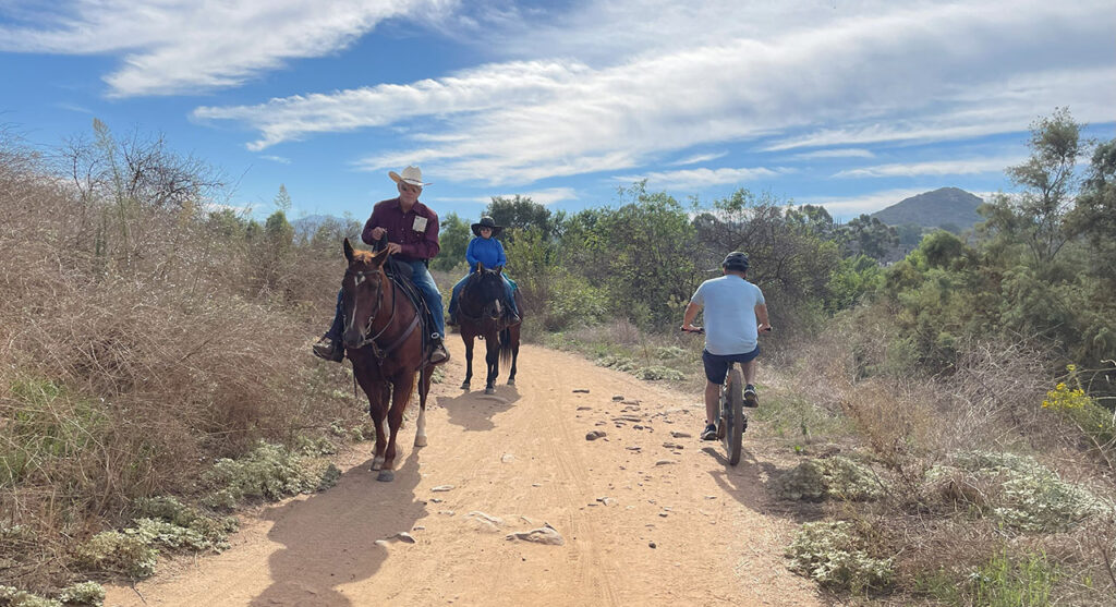
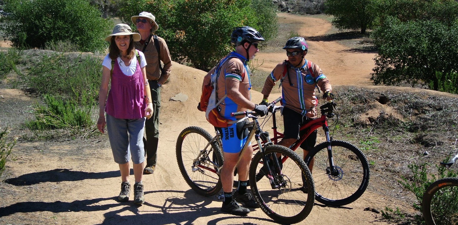
Most trails are open to hikers, bikers, and equestrians.
The backbone multi-use trail (the Coast to Crest Trail) extends from the ocean at Del Mar to the San Dieguito River’s source on Volcan Mountain near Julian.
Today, we have 49 miles of the planned 71 miles of the Coast to Crest Trail completed. In addition, over 20 miles of auxiliary trails within the River Park are open. Auxiliary trails are not part of the Coast to Crest Trail, and may have limited use regulations which will be clearly noted.
Interactive Trails Map
Explore the park and plan your trip with the interactive San Dieguito River Park Map (link opens in new window) (ArcGIS story map). This engaging map gives visitors a preview of everything needed to plan an excursion to make it an enjoyable trip including a spatial overview of the expansive trail network, park amenities, and more.
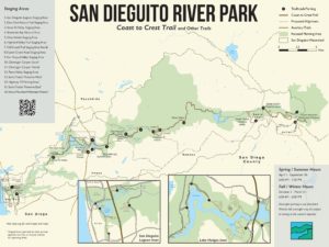
Trail maps can be accessed below.
Click on the Trail Name to download or print a PDF of the map and information about the trail.
Click on Parking Directions for driving directions, parking, and access information.
Trail maps are also typically available free of charge at kiosks along the trails.
The trails are presented in four main groups, going West to East:
For best viewing experience on mobile devices for trails information, turn your device to Landscape mode.
TRAIL NAME | MILEAGE | DIFFICULTY | HIKING | BIKING | EQUESTRIAN | HIGHLIGHTS |
|---|---|---|---|---|---|---|
2.50 | Easy | Yes | Yes | Limited | Birdwing Open Air Classroom, Lagoon Views,Birding, Osprey Nest Platforms, Interpretive Walk with QR codes | |
1.15 | Easy | Yes | No | No | Torrey pines, loop trail, secluded feel, views | |
1.70 | Easy | Yes | No | No | Series of 3 loops, overlooks seasonal ponds |
TRAIL NAME | MILEAGE | DIFFICULTY | HIKING | BIKING | EQUESTRIAN | HIGHLIGHTS |
|---|---|---|---|---|---|---|
2.9 | Moderate | Yes | Yes | Yes | Switchbacks, 7 bridges | |
2.27 | Moderate | Yes | Yes | Yes | Bridge over gorge, geology features, Rattlesnake viewpoint near Dam Flume | |
7.65 | Moderate | Yes | Yes | Yes | Great Mountain Bike Trail, Birding, Old Hwy 395 | |
1.95 | Strenuous | Yes | Yes | Yes | 360 degree views | |
1.15 | East/Moderate | Yes | Yes | Yes | Lake views | |
David Kreitzer Lake Hodges Bicycle Pedestrian Bridge – Open 6am to 9pm daily. Trail Map Location  | 0.19 | Easy | Yes | Yes | No | Longest stressed-ribbon bridge in the world. |
0.46 | Moderate | Yes | Yes | No | Paved | |
2.20 | Easy | Yes | Yes | No | Interpretive, Green Valley Creek Bridge, Seasonal Waterfall | |
1.60 | Easy | Yes | Yes | No | Loop trails, Birding | |
2.10 | Easy | Yes | Yes | Yes | Under the oaks, Children’s Interpretive Walk | |
1.40 | Easy | Yes | Yes | Yes | Historic Interpretive, Sikes Adobe | |
8.85 | Moderate | Yes | Yes | Yes | Raptor Ridge, Agricultural Preserve |
TRAIL NAME | MILEAGE | DIFFICULTY | HIKING | BIKING | EQUESTRIAN | HIGHLIGHTS |
|---|---|---|---|---|---|---|
2.00 | Strenuous | Yes | No | No | Views, Santa Ysabel Creek crossing | |
3.60 | Strenuous | Yes | No | No | Views | |
3.3 | Moderate | Yes | Yes | Yes | Shady | |
3.3 | Easy | Yes | Yes | Yes | Cattle Ranching, Valley Views, 3 Road Crossings | |
4.9 | Strenuous | Yes | Yes | Yes | Views, Engelmann Oaks, Vehicle Traffic |
TRAIL NAME | MILEAGE | DIFFICULTY | HIKING | BIKING | EQUESTRIAN | HIGHLIGHTS |
|---|---|---|---|---|---|---|
3.88 | Strenuous | Yes | Yes | Yes | Expansive Oak Savannah Views | |
7.40 | Strenuous | Yes | Yes | Yes | Views from west entry, Cattle Ranching, two loop trails | |
2.35 | Strenuous | Yes | Yes | Yes | Hubbell Gateway, desert and mountain views | |
1.2 | Strenuous | Yes | No | No | Shaded oak woodland |
Park Rules
For your safety and the preservation of sensitive habitat, please observe and obey all posted park regulations on the trails and staging areas. Off-trail activities damage valuable habitat. Repeated violations risk the closure of trail segments. Please be familiar with the general Park Rules prior to your visit.
When trails get soaked after a rain, we encourage visitors to wait 48 hours before using them to let the trails dry out. Bicycle tires, horse hooves, and even shoes and dog paws can damage the trail tread while it is soft and muddy, and this can cause further erosion during subsequent storms. Thank you for your understanding.
San Dieguito River Park Trails Management
Some trails or trail segments are within preserves or areas that are inside the San Dieguito River Park Focused Planning Area but are managed by other agencies. Please visit the following websites for news and information about these trails:
- City of San Diego
 – Crest Canyon, Gonzales Canyon, Black Mountain, and Clevenger Canyon.
 - County of San Diego – Lusardi Creek, Del Dios Highlands, Santa Ysabel West and East, and Volcan Mountain Wilderness Preserves.
- City of Del Mar – River Path Del Mar.
- Cleveland National Forest – Upper Santa Ysabel and Lower Santa Ysabel Truck Trails.
Specific trail alignments will be developed in cooperation with landowners and leaseholders in order to minimize impacts to existing use, such as farming, cattle ranching, and private residences.
The San Dieguito River Park Google Map (map opens in new window) can also be used to plan your trip. Click the + or – signs on the lower left corner on the map to zoom in or out. Click on the top left box with an arrow to bring up a menu of all the different parking areas (P symbols), trail segments, and points of interest (arrow pointing to the star symbols). Clicking on an individual parking area, trail segment, or point of interest will bring up more information about it. (For trail segments, you may need to uncheck the Focused Planning Area first.) The Coast to Crest Trail is shown in blue. Auxiliary trails are shown in orange. The San Dieguito River Park Focused Planning Area is in purple.